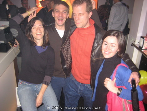
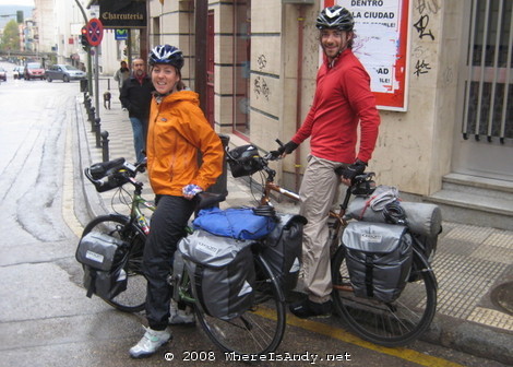
Well, I said I’d do it, and despite numerous people telling me that I was crazy, I did. After four or five days in Madrid catching up with people (including this unlikely rif raf pictured below), playing far too much GTA IV on Jon’s PS3 and stocking up on Maps at the wonderful Tienda Verde, I set off in the general direction of Valencia.
Day 1: Arganda del Rey to Algarga
Distance: 59km
Highest Point: 760m
Lowest Point: 550m
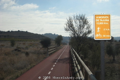
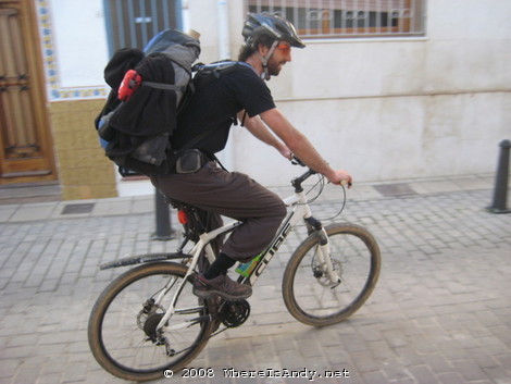
I had no maps for the first part of the journey as I’d found much talk on t’interweb of this Via Verde, a disused railway line converted into a cycle path, which would take me from Arganda del Rey some 45km in the approximate direction I wanted to go in. So I jumped onto the Metro with bike and backpack and amidst many a strange look from the Madrileños, made my way to Arganda del Rey. Ok, taking the Metro out of Madrid was cheating slightly, but as anyone who has ever visited Madrid will know, it is not a place for cyclists.
Once onto my dedicated cycle path, and after a steady two hour climb I started to realise how much the extra work the weight of my backpack (some 16kg) was generating. My plan beyond this cycle path was to do as much cross country track riding as possible, but lugging this extra weight on my back made me realise that this was not going to be possible.
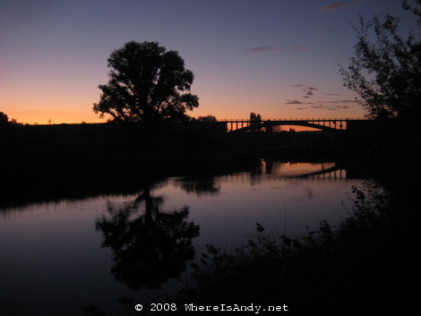
Despite starting quite late I managed a fair distance, most of it on this cycle path, on which I only saw two other cyclists during the whole day. As the light faded I set up camp next to the river Tajo in a spot where the long grass had been conveniently flattened for me. I didn’t realise until I was rudely awoken by cow bells, that it wasn’t the local youth that had flattened the grass (despite all the rubbish littered around) but the local cattle. I was woken up, and unnerved on multiple occasions as cows wandered by and stopped and stared at my tent. The last thing I wanted was to be trampled by one of the beasts overnight.
Day 2: Algarga to Cuenca
Distance: 95km
Highest Point: 1160m
Lowest Point: 550m
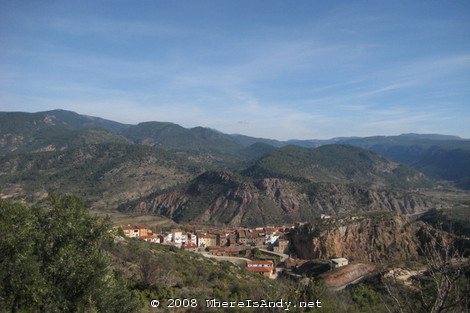
Waking up to a mist filled valley and a frost covered tent I soon got on my way to alleviate the numbness in my fingers and toes. Studying the maps with two 1100m passes to deal with an nearly 100km to Cuenca I didn’t think it would be possible in one day. The morning was slow going with lots of hills and one small sierra to cross, but the views, downhill stretches and smooth roads were very rewarding.
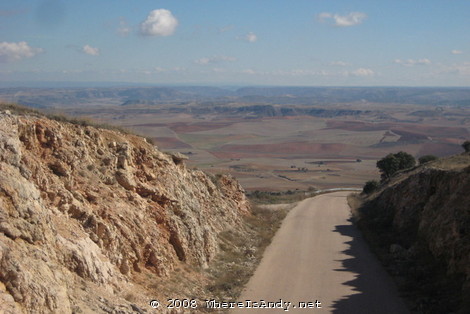
Some of the small villages were really quite special. Rustic and almost like ghost towns with no shops (travelling markets stop by, one day a week) they seem to be a forgotten part of Spain and it is fair to say that very few people ever go through them. Separated by large expanses of farm land, this particular part of Castilla la Mancha was very peaceful.
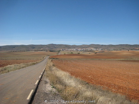
After stopping for a hefty menu del dia in Huete, I figured that with a good effort in the afternoon Cuenca would be achievable. I´d probably have to ride at night, but the thought of a warm hostel bed over camping out was motivation enough. 20km of so through a wide open valley was quite dull but the good progress made up for it. Climbing towards my second 1100m pass, seeing the zig zag road sign (something I revel in when driving) my heart sank reading “for 6km” in realisation that I had at least six kilometres of steep gradient to go. Once again the thought of a hostel bed kept me going, and after reaching the top it was pretty much a matter of coasting downhill for 10km to arrive at my bargain 14 euros a night hostel.
Day 3: Mountain Biking around Cuenca
Distance: 37km
Highest Point: 1220m
Lowest Point: 930m
Sitting down for breakfast I helped out some Canadians who were having difficulty ordering their breakfast. Naturally we got chatting, and despite my fear of ridicule, I mentioned that I was doing this bike trip. Their eyes lit up and I soon found out that the only ridicule that I was due, was for attempting such a short distance. This couple, Rob and Christina, were cycling from Helsinki to Lisbon! 9 countries in about twelve weeks. Now that is a proper cycle ride. After a lengthy, enthusiastic chat we arranged to meet up again in the evening.
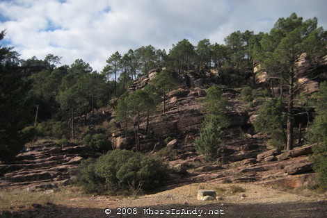
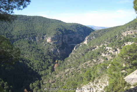
I’d planned for two nights in Cuenca, giving me time to do some off road riding in the area which was reportedly excellent. Setting off for some off road fun, it was so nice riding without the weight. I felt so free, the bike so agile and getting up hills seemed so simple. With some 1.25,000 maps I set about hunting down some trails. Unfortunately I was unable to find and decent single track stuff (what all mountain bikers yearn for) but the woodland gravel tracks were still good fun, especially when combined with the natural beauty of Cuenca. Lots of hills made it challenging, but my fun was ruined by many of the tracks being closed off due to private hunting zones.
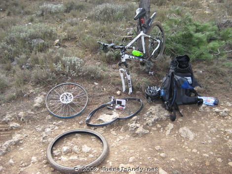
Back into Cuenca, after three punctures, nearly flattening someone’s dog and getting lost and trapped inside a fenced off hunting zone, I met up with my new Canadian friends and we hit the town for some tapas. It is always a great pleasure meeting travellers and swapping stories from all over the world. Check out the journal of their mahusive journey:
www.crazyguyonabike.com/doc/robandchris
Day 4: Cuenca to Boniches
Distance: 70km
Highest Point: 1180m
Lowest Point: 930m
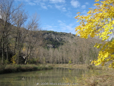
Skirting south around the Serrania de Cuenca that I´d originally planned to cross, rain and a dull, flat, straight and busy road made Saturday morning´s ride one of the least enjoyable. Conversely, once into the hills that are a lot tougher on the body, the day became much more interesting and gave a better sense of achievement.
The real highlight of the day was passing through the beautiful Rio Cabriel valley and receiving encouragement from many people who were out enjoying the outdoors; hiking, canoing or simply picnicking.
I faced a slightly different challenge when I found the road I wanted to be on closed due to road works. Thinking that on the bike I´d be able to skirt round them, I took the road anyway, but I was proven wrong when I encountered a large gap in the road halfway along it…
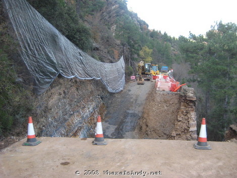
Faced with a hilly 13km detour, I sought some way of getting past this five metre drop. Skilled mountain bikers with full suspension bikes can take 5 metre drop offs in their stride, but I didn’t think I was quite up to it, especially with the weight of my backpack. I did spot the ladder that the workers used to cross the gap, so was able to climb down deposit my back pack of on the other side. Returning back I managed to find a small track that led me down to the river on my bike, travel along it a bit before scrambling up the loose surface to get back onto the road. It took me half an hour to get across, but it was much more fun than taking that detour.
That night I camped out again, this time without interest from the local cattle, although at about 1000 metres it was even colder. I really should have invested in a warmer sleeping bag…
Day 5: Boniches to Chelva
Distance: 85km
Highest Point: 1140m
Lowest Point: 480m
I had, unrealistically hoped to make it to Valencia on this day, hoping that the large amounts of downhill would enable to serious distance to be covered. The realisation that I was not going to make it late in the day came as quite a blow, especially as I was not prepared to spend another night in a freezing tent.
That aside it was another great day of lots of altitude change and stunning views, although some of the uphill sections I was not expecting were soul destroying. The 400 metre climb out of the Rio Turia gorge which I was dreading the most was actually great fun. Really hard work, but great views and a massive sense of achievement. The downhill parts were also of great relief and really rather fun, especially taking in the scenery and views of random villages stuck in the middle of nowhere.
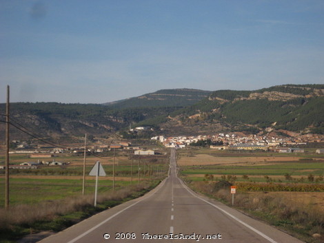
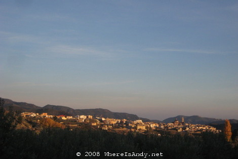
Coming around a corner towards the end of the day to see the picturesque town of Chelva drenched in the orange of the setting sun confirmed this was the place to stop for the night. After a brief wait for the owner of the only Hotel to return from the football, I settled in for a warm comfortable night.
Day 6: Chelva to Alaquas
Distance: 78km
Highest Point: 480m
Lowest Point: 42m
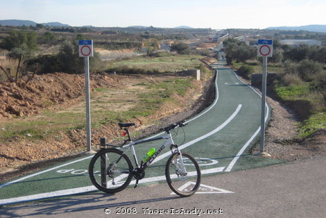
Expecting the last day to be the easiest with it being all downhill, I soon discovered that was not to be the case. Although I lost over 800 meters in height, there was an awful lot of uphill sections. The traffic was also a lot heavier than it had been anywhere else en route, so I was most content when a dedicated cycle path appeared in front of my very eyes.
Due to the urban sprawl of Valencia, the seemingly random continuity of the cycle paths and my lack of an adequately detailed map, my route for the last stretch was rather irrational adding probably in excess of 10km to the distance. Something that was very frustrating given the weight on my back, the weight of traffic and my desire to arrive. My motivation / desperation to get there was increased when Espe called to ask if on behalf of her mother if she should make a small paella or a big one. I suggested that a big one would be essential and that I would try to get there by 2pm. This was a much taller order than I expected and required a lot of extra effort, but I arrived in Alaquas shortly after 2pm, just in time for homemade Paella, of which I had three generous servings.
Being the map nerd that I am, I’ve plotted my route from memory (no GPS required) for the sheer fun of it. Take a closer look if you wish. I did a total of 424 kilometres / 264 miles in six days which for my first cycle expedition was quite a good effort. I generally kept pushing and didn’t stop to look at much. Something I would probably do differently if I were touring with someone.
Before I set of on this trip, I knew Spain was big. I also knew it was really rather hilly with six or so mountain ranges that immediately spring to mind. By cycling rather than driving, I got to appreciate exactly just how big and mountainous this place is. Something that has always blown me away about Spain is how much natural beauty and geological interest it has on offer. It really is a wonderful place to be.
So, what will I do differently for the next trip? November, for this particular region of Spain which is known for its harsh winters, was probably a bit late to do this trip. Not sleeping well in the cold and waking up to an ice covered tent weren’t exactly pleasurable. As any hardened traveller will tell you, they are always carrying too much stuff. One can always carry less, and this trip was no exception. Camping is a great way to live outdoors and a good money saver, but the equipment is bulky and does weigh some. Talking of weight, trying to carry it all on my back was stupid. There are loads of way to carry things on bikes, yet I didn’t look into any of these. By carrying the weight on my back, all this went straight through my arse onto the saddle. Most of the times I stopped for breaks was because of the pain, and not because I was tired. Carrying my luggage on a rack would have made the trip easier and more enjoyable.
I´m now sitting around on the terrace in Valencia soaking up the sun, reading a lot and very much relaxing. Something that is all the more rewarding after a trip like this.
Nevermind all this cycling malarky, where’s the ‘Ring report 🙂
(PS good effort)
Next week Sir, next week.
Andy,
It’s Rob from Cuenca….we made it to Lisbon about two weeks ago and got the bikes boxed up for our flight to the UK. Looks like you managed to make it to Valencia without any big problems. Christine and I are both in Edinburgh now and are trying to nail down some jobs. Keep us posted if you’re gonna be heading up to Scotland in the near future and we’ll do the same for Bristol.
Keep in touch,
Rob (p.s. sick pics from Nurburgring!)
Hey man!
You were very close to my father’s village in Cuenca (Villalba de la Sierra). The “Serrania de Cuenca” is an excellent area to do mountain biking, in fact we have our bikes permanently there 😉
Un abrazo,
Raul